
New Lenox ZIP Coverage
The only standard postal ZIP verified for New Lenox in the research is 60451. The official New Lenox Post Office page lists the station at 300 N Vine Street with the postal form 60451-9998. No verified PO-box-only or unique institutional ZIP was found. Nearby Joliet, Frankfort, Mokena, Manhattan, and Homer Glen ZIP areas should not be assigned to a New Lenox address without a result from the USPS address tool.
| ZIP | Area Served | Post Office | Research Note |
|---|---|---|---|
| 60451 | New Lenox postal addresses | New Lenox Post Office, 300 N Vine St | Postal geography may cross Village and township lines |
This one-row table is deliberate. Inventing a second ZIP from a nearby town would make the New Lenox ZIP code directory less accurate. The address-level USPS result is the sound way to test an edge location.
The official station listing shown below confirms the New Lenox postal facility and ZIP.
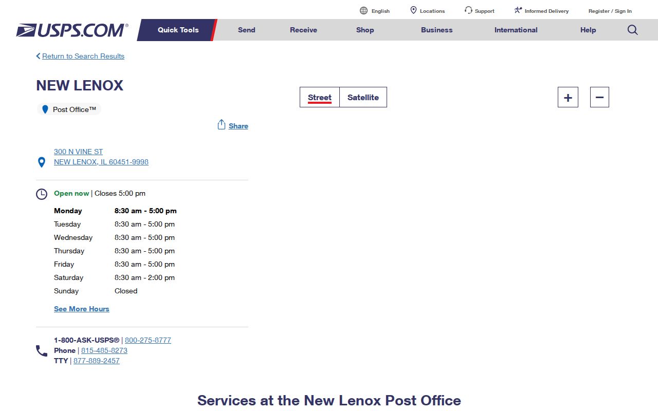
The station page proves postal service information. It does not prove that any person or company receives mail at a given street address.
Verify a New Lenox ZIP
Use the USPS ZIP Code Lookup when a road sits near a town line or the address will not match a county portal. The tool accepts an address or a city and state. Preserve the standardized street form and ZIP+4 that USPS returns. Then compare that form with the Will County 9-1-1 address point and the assessor's situs address.
| Lookup field | How to use it | What it establishes |
|---|---|---|
| Street address | Enter the number, street, unit, city, and state | USPS standardized delivery form |
| City and state | Browse postal ZIP results for New Lenox, Illinois | Postal city association, not parcel jurisdiction |
| ZIP+4 result | Save the full result when supplied | A finer delivery segment, not resident identity |
A mismatch is useful. It may signal a wrong suffix, an old road form, a new subdivision, an unincorporated parcel, or a mailing address that differs from the property location. Do not force every source into the USPS spelling.
If the postal form and county address point still conflict, contact the Will County 9-1-1 Address Assignment and Verification office. County research identifies that office as the source behind assessor address data. For a new or changed street, also check Village agendas, subdivision plats, and recorded legal descriptions. No complete New Lenox street-renaming chronology was found, so the record trail must be built for the exact parcel.
Search New Lenox Residents by ZIP
After 60451 is confirmed, use it as one identity check rather than a browse command. The Illinois voter lookup requires a first name, last name, birth date, and five-digit ZIP. It does not expose a public list of everyone in that postal area. Property portals work better from a street, owner name, or parcel number, while GIS shows which public boundaries surround the address.
- Verify the complete street address and ZIP with USPS. Save the standardized form.
- Search the Will County assessor by address. Use the optional city or town field only to narrow matches.
- Open the parcel in county GIS and inspect the municipal-limit, address-point, and district layers.
- Use the state voter tool only for a known person with the required birth date and ZIP.
- Once the ZIP search reaches one road, continue with the New Lenox street directory workflow.
The public voter form uses ZIP as part of a four-field identity test. Illinois rules restrict voter data and redact sensitive fields from released electronic files. A personal New Lenox ZIP code directory cannot be built by scraping that lookup.
New Lenox ZIP Versus Limits
Postal, municipal, and township maps answer different questions. New Lenox is an incorporated Village in Will County. New Lenox Township extends beyond it. The postal delivery area is another shape. A parcel can use New Lenox in its mail while remaining outside the Village, and the Village zoning map marks unincorporated parcels as white or uncolored.
That split changes where a record is held. Village Community Development keeps permits and zoning records for incorporated parcels. Will County Land Use can hold those records for an unincorporated site. The assessor, recorder, and county GIS still provide countywide parcel links. Use the legal boundary rather than the 60451 label to choose the office.
The Will County municipal boundary layer provides the map evidence pictured below.
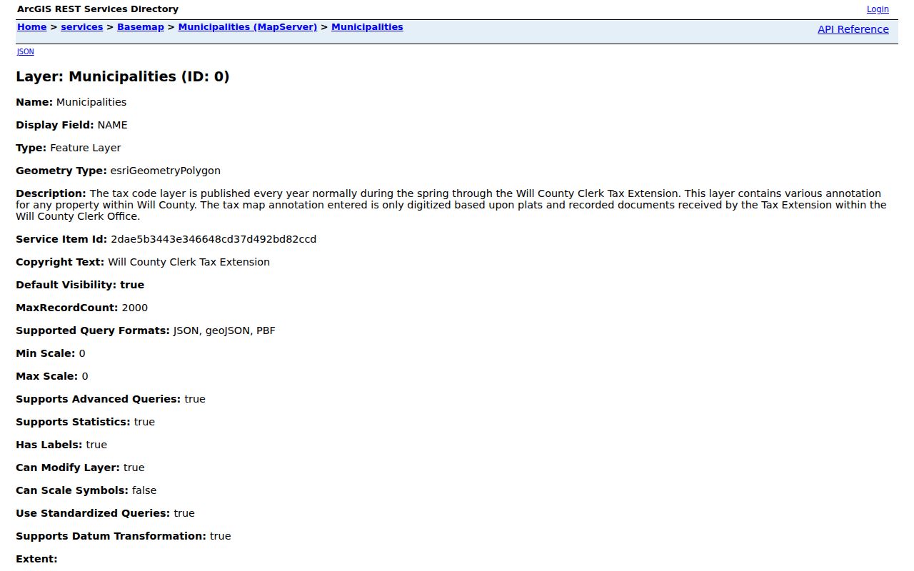
The layer identifies the Village polygon. It should be paired with the current parcel and address point because map publication dates change.
New Lenox ZIP Address Layers
Three address forms often appear in one records search. The situs address is the parcel's physical location. The tax mailing address tells the treasurer where to send the bill and may belong elsewhere. The postal form controls mail delivery. A deed adds a legal description and parcel identification number, or PIN, that can survive changes in street wording.
- ZIP code
- A five-digit USPS delivery area. It is not a city boundary.
- ZIP+4
- The basic ZIP plus four digits that narrow a delivery segment.
- PO-box ZIP
- A ZIP used for post-office boxes. None was verified as a separate New Lenox ZIP.
- Unique ZIP
- A code assigned to one large receiver. None was found for New Lenox.
- Carrier route
- A postal delivery path within a ZIP, not a resident roll.
When the forms disagree, keep each one with its custodian. The Will County 9-1-1 office maintains the address data used by the assessor. GIS address points and streets are updated weekly. The treasurer's correction process proves that mailing data and the site address are separate fields.
New Lenox ZIP Parcel Search
The Will County Property Search Portal offers six routes: parcel ID, property address, sale date or amount, subdivision, owner name, and property class. It does not provide a documented ZIP-only browse mode. Start with the verified street address instead. Street-only and number-only searches can return several candidates, and the city or town field can narrow them.
New Lenox parcels also carry a local PIN quirk. The 14-digit computer code is 08, while the 16-digit code is 15. Partial six-segment PIN searches are accepted. Keep those forms with the parcel result, then open the GIS map. This is more precise than treating every 60451 mailing label as one legal area.
County GIS dates matter. The municipal boundary layer was dated March 2026, parcels summer 2026, and address points weekly in the research snapshot. Map data help select a custodian but are not a legal survey.
The recorder adds one more check when an address search stalls. Its free Direct Search index normally reaches back to about 1965, while older documents require the Joliet archive, microfilm, books, or maps. Search by address, PIN, party name, recording date, document type, or book and page. Images and certified copies use separate paid channels. The index links people to recorded documents, but it does not certify who lives on the parcel now.
New Lenox ZIP Geography
Road and rail history helps explain odd address labels. Route 30, also called Lincoln Highway, runs east and west. Cedar Road is a north-south spine. Interstate 80, Interstate 355, and the Route 6 area frame newer growth. Early sources may say Tracy, Van Horne Point, Gougar Crossing, or New Lenox Township instead of the modern postal city.
The Village incorporated in 1946, long after settlement and the first county directories. It became a home-rule unit in 2008. Current subdivision growth also pushes the municipal edge. A modern ZIP code directory should therefore use old place names when searching historic records and current GIS when deciding present jurisdiction.
Nearby towns provide geographic context, not substitute ZIP facts. An edge address should be tested in USPS one street at a time. That keeps Joliet, Frankfort, Mokena, Manhattan, or Homer Glen delivery areas from being attached to New Lenox without proof.
Growth makes these checks time-sensitive. Village planning material describes new subdivisions in northwest, southeast, and central areas, along with a long-range incorporation area larger than today's legal Village. That statement is planning context only. Use the current county municipal polygon, the Village zoning map, and the exact parcel on the day of the search. A proposed annexation does not change the record custodian until the legal boundary changes.
Limits of New Lenox ZIP Lookup
A ZIP can sort mail and narrow an official search. It cannot identify every person at an address. Tax records may name an owner who lives elsewhere. Renters, children, and other household members may not appear. Voter data are subject to Illinois inspection, redaction, timing, and use rules. Address Confidentiality Program participants use protected procedures, and private Smart911 safety profiles are not a public resident source.
Use the New Lenox ZIP code directory for lawful personal research, family history, parcel questions, and civic records. Confirm a person with more than one independent source. Never infer a household tie from the shared postal code alone, and do not use ZIP data to stalk, harass, or harm anyone.
Keep the date and source beside every saved result.